Showing posts with label Bicycling Maine 2015. Show all posts

Bicycling Maine (9) - To Boothbay Harbor

Day 4: Memorial Day, May 25, 2015
Bailey’s Island to Boothbay Harbor and beyond:  67 miles (averaging 10.5 mph)
While Rob cooks oatmeal for breakfast outside on our camp stove, I wander into the hotel office to check out the free continental breakfast, expecting the usual packaged, sugar-loaded pastries and grocery-store bagels. Instead I find baskets filled with homemade muffins, covered with tea towels, still warm. And enormous - I juggle two muffins in one hand and a cup of hot tea in the other.
I hand off a muffin to Rob, then sink into an Adirondack chair. The view of the harbor in front of us, the blue sky, gentle breeze and a bowl of hot oatmeal mixed with walnuts and raisins beats any restaurant. I bite into my muffin, still warm and bursting with blueberries, so moist it needs no butter.
I hope the proprietor doesn’t think me too greedy when I grab a couple more muffins for the road.
Last night we looked over the map, measured the miles and realized that if we really want to get to the Canadian border we’d have to bypass all these peninsulas. So instead we’ll just ride our 50 miles or so each day and let the destination surprise us.
For tonight, we'll camp outside Boothbay Harbor, assuming we find the campground, it allows tents, and Rob doesn’t come up with another reason why we should stay in a motel. I’m sick of carrying all this damn camping gear and not using it.
We ride to the other end of the island where we find the Bailey Island Lobsterman.
The lobster theme pervades
the Maine seacoast.
Then we ride to Bath, perched on the Kennebec River. We arrive shortly before the Memorial Day parade starts, the town filling up with spectators. It feels too crowded so we don't stay long.
Before we get back on our bikes I call our daughter, just to check in, expecting a hi-how-are-you-everything's-fine phone call. But it's not that. She has news of a tragedy she needs to share, a favorite high school teacher found dead, an apparent suicide. He had only recently retired, having taught social studies and psychology for many years. When I met him, I appreciated his strong Long Island accent, an accent so like my mother's. He loved to hike the White Mountains and told his students how he climbed Mt. Washington many times in the winter. Rob visited his psychology classes every semester to answer students’ questions about the field. He always offered to take Rob kayaking as a way to say thanks, but somehow they never got around to it.
We cross the bridge out of Bath, over the Kennebec River, riding on Route 1 into Wiscasset then down Route 27 towards Boothway Harbor, too much traffic speeding by on roads without decent shoulders and why are they going towards a tourist spot on the Monday of a holiday weekend when they should be going home?
But the traffic is just an annoying distraction from my thoughts of this man who loved the outdoors, hiking and kayaking. Yet, that wasn’t enough to save his life.
We arrive at Shore Hills Campground in mid-afternoon and set up our tent with time for more riding. To avoid traffic we set off on a local road on a loop that looks, from the map, like it might have some nice views, but it doesn’t, really. At least the traffic is considerably lighter.
 How seaworthy is this boat?
Finding our way to downtown Boothbay Harbor, we stop on one of the streets just off the waterfront. The town has a quaint feel to it in spite of the garish signs advertising boat tours.
We lock our bikes to a lamppost and walk around but most of the shops have closed for the day. Around the corner we find a specialty wine and cheese shop that’s still open, buy a small bottle of wine, some cheese, and a loaf of French bread for dinner, and sit outside to eat at a picnic table overlooking the harbor.
We tend to think of the Memorial Day weekend as ushering in summer. But summer hasn’t even started knocking on the door here. A cold wind starts blowing, and, as we eat, it starts to rain. Thankfully it comes down sporadically, as we put on rain gear and drink up the wine. We arrive back at the campground before the rain begins in earnest.

Tomorrow we'll start another day of riding, and thoughts of a teacher's suicide will dissipate as others take their place. It seems callous, in a way, that we give what seems like only a passing thought to someone else's tragedy and then just go on with our lives. But maybe that's the way it should be. Now is our time to fill up our buckets with adventures and joyful moments, building memories that will get us through the sorrows that will someday be ours.

Bicycling Maine (8) - Early Morning on Bailey's and Orr's Islands


Day 4: Memorial Day, May 25, 2015

     Rob got up early and wandered out for a walk, camera in hand. 

Catching the sunrise.


The back of Morse's Cribstone Grill, 
windows reflecting the sun's early rays.

Rob took this from the Cribstone Bridge 
looking towards Bailey's Island.


Colorful lobster buoys hanging on buildings is very Mainely.

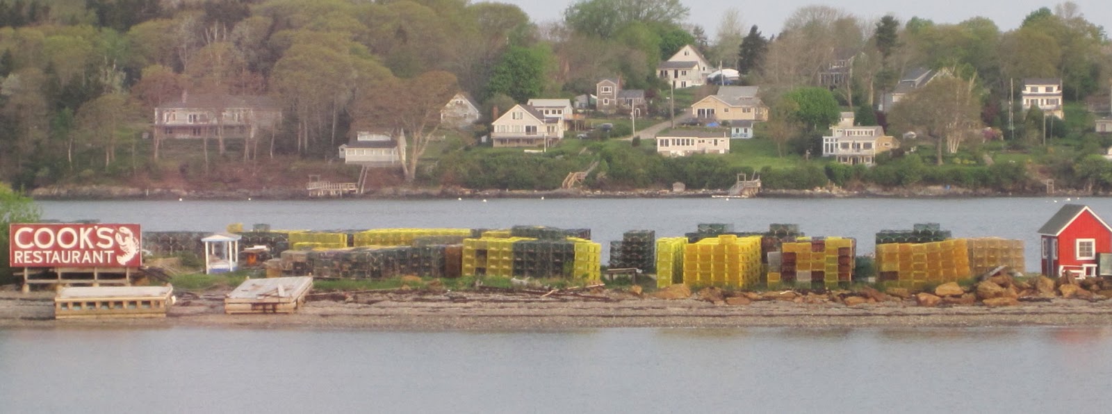
And stacks of lobster traps can be seen everywhere.

The myriad colors of the kayaks on Orr's Island caught the photographer's eye, 
providing a welcome break from the lobster theme.


Bicycling Maine (7) - Nothing Ordinary About This Bridge

May 24, 2015
The Cribstone Bridge

Morse's Cribstone Grill
After cleaning up we wander next door to Morse’s Cribstone Grill, a basic seafood restaurant, nothing fancy. Trying to find something healthy – not fried - I order the broiled haddock, which turns out to be rather bland. Rob orders the same and his tastes fine. Then again, he grew up with bland food.
We finish our meal and it’s that time of day when you’re on vacation and you have nowhere you have to be and nothing you have to do and you’re in a beautiful place where you’ve never been before. The sky is mostly clear with just enough clouds to promise a spectacular sunset, the temperature perfect for a stroll across the bridge adjacent to the restaurant. We didn’t really pay it much attention when we bicycled across it earlier, nor do we pay it much attention now, we’re so taken with the view of the boats, the horizon, the colorful pile of kayaks on the other side. But when we cross over it, we notice a sign saying it’s a historic landmark.
Constructed in 1927-28, the design of the Bailey Island Bridge presented a challenge because of the strong tides. Copying a bridge in Scotland, it was built using granite slabs stacked one upon the other in an open cribbing style to permit the tide to ebb and flow freely. Today it is the only bridge of its kind in the world.

We wander onto the beach to get a closer look. A manmade structure designed solely for a utilitarian purpose, yet stunning in its simplicity. I wonder how many people cross over it and – like us – don’t even notice its uniqueness. But now we don’t squander the time we have  to marvel at the light shining through the open cells, at its random yet orderly structure. And maybe it's all the more beautiful because we knew nothing about it when we landed here unexpectedly for the night.
Look carefully where the arch is at its highest and
you will see the opening that allows boats to pass through.


Bicycling Maine (6) - Where's the Campground?

Day 3: Sunday, May 24, 2015
Yarmouth to Bailey’s Island:  38 miles (averaging 10.72 mph)

Sometimes, when the riding gets tough – my butt so sore it feels like I’m sitting on top of a flag pole, the legs tell me they’re done for the day and I tell them we have at least 20 more miles, and here comes another hill to climb while traffic is roaring by at 60 mph and I’m hanging onto a narrow shoulder pockmarked with pot holes  – I wonder how I can think this is fun. Then, the next day, we meander down scenic back roads with a light breeze and the temperature in the seventies, the views opening up on pristine bays and rock-strewn coasts, and I feel sorry for all the poor fools who think that riding a bicycle is work.
And today is just that day. We get started shortly after noon and ride a bit on U.S. Route 1, where the highway runs quietly for a stretch without the bother of coastal towns and their restaurants, strip malls and tacky tourist traps.  Then we’re off on local roads that loosely follow the coastline. We stop for a late lunch at a boat launch, overlooking a peaceful bay. As we eat we watch the sky darken and rain begins to fall and we put rain covers on our panniers.
We stop for lunch at Wharton Point boat launch.

But it doesn’t rain and the riding is fine, even as we start getting into some hills. Then we're starting our tour of Maine's peninsulas and a few of its many islands. (Maine has over 3000 islands – 3166 if you believe Wikipedia. But, according to waterfrontpropertiesofmaine.com only 41 of these are inhabited.)
           We ride across causeways and bridges and by now we have likely arrived on Orr’s Island and should be getting to our campground. Which we can’t seem to find. We pass cemeteries and ponds and woods and driveways and dirt roads and a sign for a motel, but nothing about a campground.

A garden catches our attention and alongside is a café. Inside, Rob waits patiently in line, then asks the woman behind the counter if she knows anything about the campground. Is it open? 
“Oh, yes. It should be open. Head back north, past the cemetery and when you can see a pond on your right look for the dirt road on the left with a wagon wheel at the end of it.”
We ride back a mile or so and find the cemetery and there’s the pond but we still haven’t seen any sign for a campground. We turn around and try again, stop along the side of the road and then we do see a dirt road with a wagon wheel. But there's no sign. We ride down the road anyway, and there's the campground in a gorgeous spot overlooking the water which would be a lovely place to spend the night. But not for us. There's a sign that  welcomes seasonal RVs, but no tents because there's no bath house. So that’s that.
I take the turn off the dirt road onto the highway just a tad too sharp and don't unclip out of my pedals in time. I hit the dirt, indignity added to disappointment.
At this point, anyone else would pull out his or her smart phone and ask Siri where’s the nearest campground, or motel or B&B. But all we have is a dumb phone that is next to useless once we’re beyond any major populated area.
So instead of asking Siri, I ask Rob, “Did you see that sign for a motel? Let’s check it out.”
We follow the arrows into a residential neighborhood and bicycle around in what feels like suburbia and an unlikely place for a motel. I go up one road and Rob another and when a car stops at an intersection Rob talks to the driver, who tells him the motel was turned into condos a few years ago. I guess nobody cares about updating those blue highway signs.
No campground, no motel.
We stop back at the café and this old guy sitting at a table drinking coffee says there are several motels down the road. It’s Memorial Day weekend. What are the chances of a room being available?
We cross the bridge to Bailey Island and straight ahead, on the other side, is a motel. 
Straight ahead to the Bailey Island Motel
Inside the office, I ask the woman behind the desk about a room.
“I can give you one for $125.”
“That’s a little more than we were hoping to spend. Are you the only place around?”
“There’s another motel down the road. It’s cheaper but we have a better view.” 
“What are the chances of you renting out your last room while we go check it out?”
“We have plenty of rooms left.” Evidently the tourist season hasn't started. “I’ll tell you what. I can let you have a room for $100.”
Outside, Rob and I discuss our options. I can totally get into parking myself in one of the Adirondack chairs overlooking the harbor, and Rob's got his eye on the restaurant next door.
The budget will take a hit tonight.


[The Bailey Island Motel turns out t be a real gem. Check out this newspaper article which describes it perfectly. You’ll want to visit, for sure.]

Bicycling Maine (5) - Planning a No Itinerary Trip


Sunday Morning, May 24, 2015
Even though we like to travel with no set agenda, we still try to formulate a plan for each day, taking into consideration how far we feel like riding and where we might be able to spend the night. Because at the end of the day, it’s nice to be able to clean up, have something to eat, and have a safe and somewhat comfortable place to sleep. (As much as I enjoy winging it when I travel, I have so far managed to avoid having to throw my sleeping bag down by the side of the road.) Even so, any plans we start the day with are subject to change at a moment’s notice, because you never know what adventure lies ahead.
Here’s an example. In 1989 we were riding for two weeks in Nova Scotia. Our goal each night was to stay in either a provincial or national park campground because they tend to be so much nicer and cheaper than private ones.  This particular day, the closest provincial campground was only 15 miles away and the next one too far, so we decided we'd have to make a private campground our destination and planned our route for the day accordingly.

That morning the riding was both fun and stunningly beautiful – rolling hills with panoramic views of green valleys and farms. When we stopped for lunch and looked over the map, we discovered that we were on a scenic route that looped back to the main road we had started out on. We decided to stick with it and finished the day camping at a provincial campground after all - the one just 15 miles from our starting point.
Bicycling Nova Scotia in 1989
So here it is, the third day of a two-week trip meandering along the Maine Coast with a hopeful destination of the Canadian border before turning around and bicycling home to Madbury, New Hampshire. What's the plan going to be today? Even though we spent Friday night at a hotel (celebrating our anniversary) and last night with our friends Sally and Steve, we have brought along a full complement of camping gear. I’ll be damned if I’m going to carry all this gear and not use it. We’re camping tonight.
We rode 45 miles on Friday and 77 yesterday. How far today?
In 1980 I cycled solo from Boulder to San Francisco, by way of the Canadian Rockies. I spent eight weeks on the road, clocking 3000 miles when I rode over the Golden Gate Bridge. Some days I rode a hundred miles; if I needed a rest day I’d ride fifteen. Occasionally I’d take a day off to hike. In the end, my average came out to 55 miles a day.
But the image of some beautiful gardens I passed in Victoria, on Vancouver Island, stuck in my head. I didn’t stop because, at the time, I was just tired of being alone and thought there was no point in stopping when I had no one to share it with. I thought about that - and other days when I wanted to rest but had no one to spend the day with – when I looked back on my trip and decided that, on any future trip with a friend, 50 miles a day might be about right.
And that’s pretty much what Rob and I have done. On that trip in Nova Scotia, with no plans and much spontaneity, we had days when we rode over 90 miles and days when we didn’t ride at all. After 13 days, we'd ridden 650 miles - exactly 50 miles a day.
So with 122 miles behind us, if we are loosely aiming for a daily average of 50 miles (we haven’t yet made an adjustment for our advanced ages), we can take it a little easy today.
Sally makes blueberry pancakes and we sit around the breakfast table enjoying our coffee and tea and catching up on each others’ lives and no one is in any hurry to get moving on the day.
We talk about our problem of getting through Portland without a detailed map.  Steve suggests we get the DeLorme Road Atlas of Maine (delorme.com/mapstore/) . They make one for every state. “The company is right here in Yarmouth,” he says. “You can pick one up at the grocery store.” 
He shows us his copy. The state is cut into grids with detailed maps – showing local roads - of every section, and symbols for every campground and state park. It’s perfect. Except it’s unwieldy and heavy and we won’t need the whole thing.
I ask Steve, “How about we pay you for your copy? Then we can cut it up and take what we need and you can buy a new one.”
Now that we have a more detailed road map, we realize the challenge of actually riding the coast of Maine. So many peninsulas, little ones, big ones, you ride to the end of one – then what? You back track and head to the next one. Clearly we can’t get to all of them. Not if we are even going to have a prayer of making it all the way to Canada. So, we pick and choose.  We look for a campground about 40 miles away and discover a route that takes us partway down one peninsula, crosses over to another, and ends up at a campground - there's the little symbol - on Orrs Island.
The map doesn’t show mileage, so we do it the old-fashioned way. I take a scrap of paper and with the legend I measure two miles on the edge. Then I use it to roughly trace the route we’ve chosen and come up with 40 miles. I hand the paper and map to Rob. “Here. See what you get.”
Rob say, “I get 40 miles.”
Perfect.
Steve warns us that north of Portland we’ll be hitting a lot of hills. But we don’t really give it any thought, having ridden in Vermont, New Hampshire, California, and Colorado. We know hills.

Maybe.